
This Week's Show
Air Date: July 3, 2026
FULL SHOW
SEGMENTS
Exploring The Parks: North Cascades National Park
View the page for this story
As we mark America’s 250th birthday, we celebrate parts of America’s enduring ecology, including our national parks. At the heart of one of Washington State’s most expansive wild ecosystems is North Cascades National Park, just a three-hour drive from Seattle yet one of the lesser-known parks. Saul Weisberg, founder and executive director of the North Cascades Institute and super docent of the North Cascades, joins Host Steve Curwood to talk about his years exploring the park. (10:26)
The Enduring Wild and Public Lands
View the page for this story
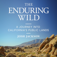
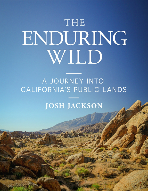
Around 30% of the land in the United States is federal public land, and the biggest chunk or 245 million acres falls under the purview of the Bureau of Land Management. BLM lands are sometimes called “leftover” or “forgotten” lands, but they offer free or very cheap camping and feature a stark beauty that captivated writer and photographer Josh Jackson, author of the 2025 book, The Enduring Wild: A Journey into California’s Public Lands. He speaks with Host Jenni Doering about some stunning BLM lands to start exploring. (20:34)
The Spectacular Regrowth of New England Forests
View the page for this story
When European colonists landed in North America, some of the most dramatic changes they made were to our forests. Clearcutting ran rampant, but now, on the 250th birthday of the United States, much of our forests have recovered, particularly in the Northeast. Bill Moomaw, Distinguished Visiting Scientist at the Woodwell Climate Research Center, tells that story of recovery to Host Steve Curwood and explains why maintaining our forests is vital for mitigating the effects of climate change. (14:42)
Show Credits and Funders
Show Transcript
260703 Transcript
HOSTS: Steve Curwood, Jenni Doering
GUESTS: Josh Jackson, Bill Moomaw, Saul Weisberg
[THEME]
CURWOOD: I’m Steve Curwood.
DOERING: And I’m Jenni Doering.
Celebrating 250 years of America, including the public lands we share.
JACKSON: This is what blows my mind. We live in this country that values private ownership almost in a zealous way, right? And yet somehow, we have set aside 30% of our lands and water for the public. That is an astonishing inheritance.
CURWOOD: Also, the story of the spectacular regrowth of Northeastern forests, and the case for “pro-forestation”.
MOOMAW: What we are discovering is that the forests that have been left, the ones that have been allowed to keep growing to accumulate carbon and to develop its full biodiverse potential, are doing the really heavy lifting.
CURWOOD: Happy birthday America and more, this week on Living on Earth, stick around!
[NEWSBREAK MUSIC: Boards Of Canada “Zoetrope” from “In A Beautiful Place Out In The Country” (Warp Records 2000)]
[THEME]
Exploring The Parks: North Cascades National Park
The sun breaks through early morning clouds near Easy Pass and Fisher Basin. (Photo: National Park Service, Public Domain)
CURWOOD: From PRX and the Jennifer and Ted Stanley Studios at the University of Massachusetts Boston, this is Living on Earth. I’m Steve Curwood.
DOERING: And I’m Jenni Doering.
It took more than 150 years for the descendants of the first English settlers in North America to declare their independence and create the United States of America.
And we are still way ahead of England in terms of amazing landscapes and diverse living places as we honor our 250th birthday.
CURWOOD: This week on our program we are celebrating parts of America's enduring ecology, the care we have taken over these past ten generations, and for more generations of Americans to come. But it's not all pretty.
DOERING: Some of our decisions have been shameful, and only rather recently have we begun to make up for the brutal displacement of Native Americans who tended these ecosystems going back hundreds of generations. And for years we have chopped, drilled and dredged away much of the natural beauty and bounty that first greeted the Europeans.
CURWOOD: But we have also adored and kept much, no matter what our politics.
Whether people hunted, fished, watched birds or simply loved the wild, over our past two and half centuries political party hasn't mattered. Democratic-Republican Thomas Jefferson launched the Lewis and Clark expedition in 1804 to trace and catalogue the Louisiana Purchase.
DOERING: And in 1872 Yellowstone became our first national park with a congressional act signed by Republican Ulysses S. Grant. Since then, Republican presidents Teddy Roosevelt, Richard Nixon and both George Bushes as well as Democrats Woodrow Wilson, FDR, John Kennedy, Jimmy Carter, Lyndon Johnson, Bill Clinton, Barack Obama and Joe Biden have all boosted major land conservation measures. Access to these places wasn’t perfect, of course, and sadly the Shoshone, Bannock, and other tribes were expelled from Yellowstone at its creation, and African Americans were barred from many national parks during the Jim Crow era.
CURWOOD: But access has improved as American democracy itself has improved.
Back when the republic was created on July 4th, 1776, less than 10 percent of our population could vote as women, enslaved persons and men without wealth could not mark a ballot. Today just about all citizens of age, can vote and we can now visit the millions of acres of parks and conserved lands, all free of discriminatory barriers. So, to celebrate our 250th anniversary we take you to a lesser known yet much loved national park, North Cascades in Washington State.
[SFX BIRDS AND OWL]
An owl joins a chorus of other birds at Big Beaver Valley in the northern end of the park. The North Cascades is one of the least visited of the US National Parks. Perhaps names like Mount Fury, Poltergeist Pinnacle, and Forbidden Peak keep the crowds at bay. But despite its name, the beauty of Desolation Peak has captured many hearts, including that of the beat poet Jack Kerouac and more recently, Saul Weisberg, founder and executive director of the North Cascades Institute. He joins us now from Bellingham, Washington. Saul, welcome to Living on Earth!
WEISBERG: Thanks. Thanks for having me.
CURWOOD: So for someone who's never been to North Cascades National Park, how would you describe it?
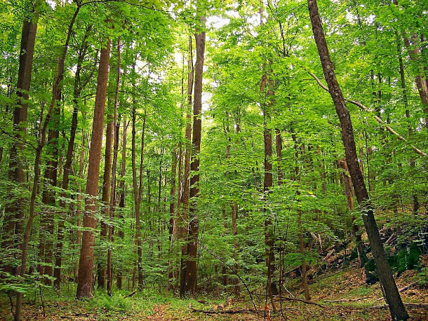
WEISBERG: Well, tucked away in northwest Washington is this amazing place of jagged mountains, glaciers, mighty rivers, big trees, incredible wildflower meadows. It's just, it's a special place. It's what the Northwest used to look like: big cedar, hemlock, Douglas-fir forests. And there's not a lot of it left and some of the best of it's left inside of, deep inside of North Cascades National Park.
CURWOOD: So the North Cascades National Park is one of only three national parks in the United States that we share some territory with Canada. There's Voyageurs, which is up in the Boundary Waters area there in Minnesota, there's Glacier National Park, and North Cascades. What makes North Cascades different from those parks?
WEISBERG: Well, one of the things that's unique about the park is that it's in the midst of this huge, wild ecosystem. And that ecosystem stretches, in northwestern Washington, it covers about 70 miles east to west along the Canadian border. The ecosystem is about 13 million acres, 7 million of the acres of that are protected public lands on both sides of the border: North Cascades National Park, three national forests, and then provincial parks in BC. And the park itself is only about six or 700,000 acres, but it's really the heart of that wild ecosystem. So it's the largest area of protected public lands across the whole US-Canada border. Very few roads go into the park itself. You have to get off on the trail, you have to climb or canoe the rivers to really get into that. And some people, climbers in particular, will access the park coming in from the north, driving around, and then hiking in through British Columbia.
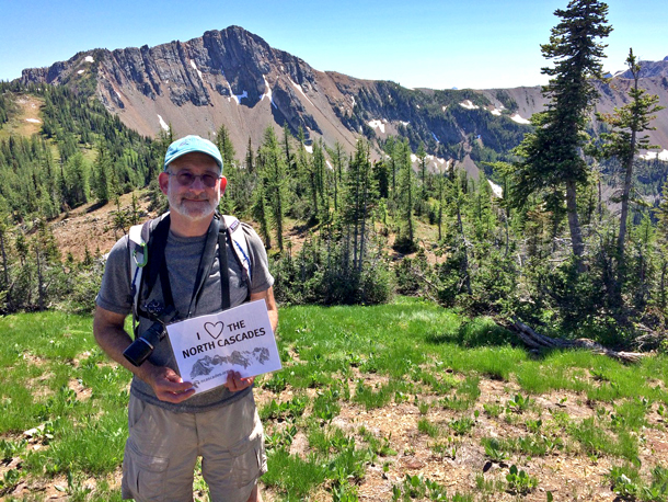
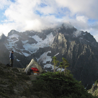
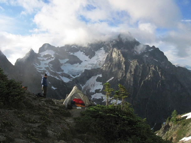
Thirty years after discovering the park, Saul Weisberg still loves the North Cascades. (Photo: Courtesy of North Cascades Institute)
CURWOOD: As I understand it, North Cascades is one of the least visited of our national parks. Why do you suppose not so many people come to North Cascades?
WEISBERG: Well, part of it's the obvious answer that it's more remote. It takes more time to get to. When you're in downtown Seattle, you can see Mount Rainier and you can see the Olympics across Puget Sound. You don't see the North Cascades until you get north. And I've had people tell me well, North Cascades, that's somewhere up near Alaska, isn't it? And these are folks in Seattle who could get there in three hours. That's part of it. The other part of the low visitation is sort of an artifact of boundaries. The park complex itself is made up of the National Park, Ross Lake National Recreation Area, and the Lake Chelan recreation area. And most of the visitors are in those two recreation areas, which hug the lakes and the one highway that crosses the range. And to get in the park, you've got to get off that road. And I think there's still only, aside from the main highway, I think there's only six miles of paved road in the park. I could have that wrong, but it means that you've got to work to get into the park itself.
CURWOOD: Indeed. Now, when it comes to glaciers, of course, Glacier National Park is famous for glaciers, but the North Cascades, I gather -- you know, you have more.
WEISBERG: A lot more. Yeah. Over 300 active glaciers. Like all the glaciers, they're shrinking, some more rapidly than others. I was a climbing ranger in the park from 1979 to 1986, and you can see the difference pretty much everywhere you look. By late summer, areas that were glaciated now have just summer snowpack. There's areas where, in the early to mid 80s, where we would go into someplace and we would find, instead of a glacier, we would find a valley with a lake in it. And so it's been happening for a while, but it's really been accelerating recently. And we've seen the same thing in terms of wildlife where marmots and pikas are going up in elevation. And at some point those species, as the glaciers leave and the climate warms, essentially fall off the top of the mountains; there's no place for them to go because they are dependent upon snowpack for their livelihood.
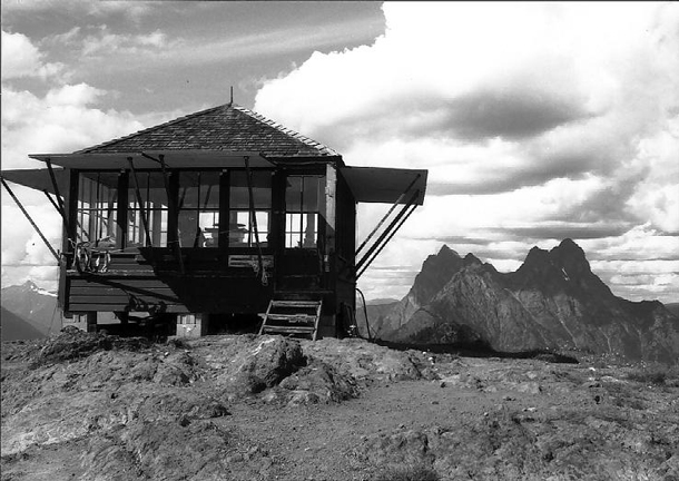
Desolation Peak Lookout with Mt. Hozomeen in the background. (Photo: Pete Hoffman, Wikimedia Commons, CC BY-SA 3.0)
CURWOOD: So talk to me about your favorite places in the park. You're a climber, so I imagine there's some really steep mountains. But, but tell me, what are, what are your favorite parts there?
WEISBERG: I've never been to a place that didn't speak to me in some way if I spent enough time there. But I must admit that the Picket Range, which is some of the most rugged, most alpine, steep, scariest part of the mountains is a particular favorite. It's one of those places where you'd plot your route, usually spend a day or two just hiking to get up into the mountains. So you'd be hiking up deep, low-elevation valleys. And then you'd camp and you'd be looking at the route ahead through binoculars and just go, there's no way. It looks like, it looks like you're looking at the Gates of Mordor. And I just love that, a wilderness that is that wild and makes you feel that small.
CURWOOD: Well, the North Cascades National Park has some pretty foreboding names to it. You've got Desolation, Despair, Fury; what's with all the doom and gloom?
WEISBERG: Yeah, and you left out Torment and a few others. It shows you how the early white settlers and miners and trappers saw the place. For the native peoples it was home. But to the people who came in there and overwintered for the first time, it was a foreboding place. The days are short; in the valleys you might never see direct sunlight in the winter, because it's just creeping along behind the mountains. And it's cold. And there's a tremendous amount of rainfall. And so it just wasn't a happy place for folks who hadn't lived there for a long time. And it's interesting because a place like Desolation Peak, which is very hard to access most of the year when there's a lot of snow there -- in the summer, it's a beautiful, open, gorgeous forest with lush meadows of wildflowers, I mean, it's a heavenly place to camp.
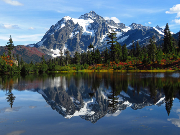
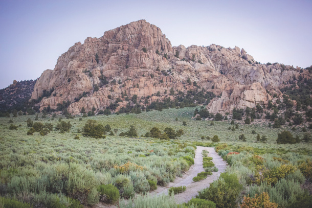
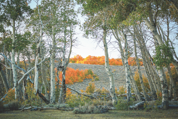
Mount Shuksan and Picture Lake at North Cascades National Park. (Photo: jeffhollett, Wikimedia Commons, CC BY-SA 4.0)
CURWOOD: Now, Jack Kerouac famously spent a couple of months camped out at Desolation Peak, calling the landscape one of the most beautiful he'd ever seen. Now you yourself have studied Kerouac and other poets, Beat poets, nature poets. In fact, you do poetry yourself. So how does poetry help you connect to the park?
WEISBERG: Poetry is how I slow down and pay attention. So when I'm hiking, I've always got a small notebook in my pocket, and I'm just jotting down an image or a thought. I call them field notes. And then gradually, over time, they kind of build and some build themselves into poems, and some never do. But it's, I often find myself, when I'm out, looking out either at a spectacular landscape, or maybe deep in the forest, just watching the raindrops cling to the branches and listen to the nuthatches in the trees. But it slows me down and makes me feel that I'm there.
CURWOOD: Saul, to wrap things up, we'd love to hear one of your poems from your collection. It's called "Headwaters." Please, if you could read that for us now.
WEISBERG: "Headwaters." With cupped hands, I bow and drink / Each day, a different stream / Many times from the same river / And once, the sea.
CURWOOD: Well, we certainly are all connected, aren't we? Saul Weisberg is founder and Executive Director of the North Cascades Institute, and perhaps you could call him the super docent of North Cascades National Park. Saul, thanks so much for taking time with us today.
WEISBERG: Well, thank you. It's been a pleasure to talk about one of my favorite places.
Related links:
- North Cascades Institute homepage
- National Geographic | “Venture into the Wild ‘American Alps’”
- New York Times | “Climbing a Peak That Stirred Kerouac”
- Saul Weisberg’s bio
[MUSIC: Skagit Valley Mist]
DOERING: Just ahead, some of the best places outdoors in America you may never have heard of. Stay tuned to Living on Earth!
ANNOUNCER: Support for Living on Earth comes from the Waverley Street Foundation, working to cultivate a healing planet with community-led programs for better food, healthy farmlands, and smarter building, energy and businesses.
[CUTAWAY MUSIC: Skagit Valley Mist]
The Enduring Wild and Public Lands
Josh Jackson’s debut book is The Enduring Wild: A Journey Into California’s Public Lands. (Photo: Courtesy of Heyday Books)
CURWOOD: It’s Living on Earth, I’m Steve Curwood
DOERING: And I’m Jenni Doering.
Author and conservationist Wallace Stegner wrote of U.S. national parks like North Cascades and of course the iconic Yellowstone and Yosemite that they were “… the best idea we ever had. Absolutely American, absolutely democratic, they reflect us at our best rather than our worst." And they certainly feature stunning scenery and wildlife as well as vital American history.
CURWOOD: But the national parks are just a fraction of the roughly 640 million acres of federal public lands across the country. That’s about 30% of all the land in the United States. The biggest chunk, around 245 million acres, falls under the purview of the Bureau of Land Management, or BLM.
DOERING: These lands are sometimes called “leftover” or “forgotten lands” because they were considered too arid or rugged for farming, so they were passed over by homesteaders. And they’re often not suitable for growing the trees overseen by another big land manager, the US Forest Service, though logging does take place on some BLM territory.
CURWOOD: Today they’re mostly multi-use places with a mosaic of recreation, wildlife conservation, grazing, mineral and fossil fuel extraction, and increasingly the prospect of data centers to power AI. Needless to say, these uses don’t always play nicely with each other.
DOERING: Still, these public lands unite us more than they divide us. They are a shared heritage for all Americans since we are co-owners of these vast public lands, and they enjoy broad bipartisan support. They also feature a stark beauty that captivated writer and photographer Josh Jackson and led to his 2025 book, The Enduring Wild: A Journey into California’s Public Lands. He joins me now from Los Angeles – Josh Jackson welcome to Living on Earth!
JACKSON: Thanks so much for having me. I'm happy to be here.
DOERING: So, as forgotten lands, leftover lands, they certainly don't have the best reputation. They're not on a pedestal the way that the national parks are, and yet you kind of fell in love with these public lands in California. You wrote a book about them. There's gorgeous pictures in here. What inspired you to set out on this journey, I guess more than 10 years ago now?
When Jackson and his family first explored California’s public lands, they were amazed at the natural beauty and “otherworldly landscape” of the Mojave Desert, pictured above. (Photo: Josh Jackson)
JACKSON: Yeah, I had always been an avid outdoor enthusiast. I'm from Michigan, so I grew up in Michigan. I moved out to the West 21 years ago, and I immediately fell in love, you know, the national parks that we have - nine national parks here in California, and lots of forest service lands, 50 million acres of the 100 million acres of land in California is public land shared by all of us and open for all of us, and even as an avid outdoor enthusiast who spent a lot of time on the coast, a lot of state park camping, a lot of national park camping, it wasn't until 2015 that I even learned about Bureau of Land Management lands. I remember I was looking for a place to camp. My wife and I just had our third child, and those last few months of pregnancy are kind of hunkering down, you're not getting out much. And my five-year-old and two-year-old at that point were pretty desperate to get out of the house, and so I looked for state park campgrounds that we could go camping at over the New Year's. My third child was only a month old at that point, and everything, of course, it's California, everything was booked solid. Couldn't find anywhere to go. I reached out to my friend, he had this special knack of finding campsites out of thin air, and he said to me on the phone, "why don't you camp on some BLM land?". This was in 2015, first time I'd ever even heard of the term BLM land, and I said, I remember saying, like, oh, okay, where is that? And he said, I think it's out in the desert somewhere. I remember thinking, oh, you don't really know either, but it like planted this seed that I got on the BLM website, which felt like going into the pixelated domains of dial-up, you know, from the 90s, super slow, not a lot of information, pictures that were like, you know, 100 kilobytes in size, very very little happening on that website. It's a little better now, but I found this place called the Trona Pinnacles which is out in the middle of the Mojave Desert. It's about three hours from L.A. I loaded up my two-year-old and five-year-old in our Honda Element, and we took off, and we had this amazing weekend camping at this really special place. It's kind of an ethereal, otherworldly landscape, where hundreds of tufa spires just pop out of the desert. They look like those drip sand castles you make at the beach, surrounded by these beautiful salt flats. So, like, as we're running around, the kids felt like it was this giant trampoline, and it's just really kind of ethereal landscape, we had the wonderful weekend together, and I remember being there and just thinking, like, what is happening? What are these BLM lands like? How many lands are there? Are there other places like this? Is this the only one? Like, it's crazy to think that now, right, because there's 245 million acres across the West, and we were at, like, you know, 500 acres.
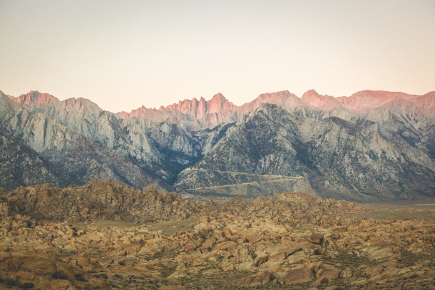
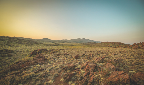
U.S. Route 395 runs along the eastern side of the Sierra Nevada mountain range in California. Since much of this land is owned and managed by the Bureau of Land Management, camping here is affordable and easy, Jackson notes. (Photo: Josh Jackson)
DOERING: It does seem hard to miss them, but we just don't know they're there, right?
JACKSON: Yeah, and I think, like, if you're driving across the West, like, you've driven right through BLM managed public lands, but that was really the impetus for, like, the curiosity that started forming about what these lands were, what kind of landscapes they contained, and so you know, at that point I had three kids under the age of six at a full-time job, and the only thing I could really do at the time was read, and so I just went to the library, I ordered books offline, and just read as much as I could, kind of pouring this foundation of understanding for all the questions that I was having. And so during all that time, those years, like this is, you know, 2016 new administration, and then, of course, in 2017 as probably a lot of your listeners understand, there was this big push to reduce the size of national monuments, which are managed by the park service, but mostly they're managed by the BLM, and so that was the first time I had really understood that there's big time threats to BLM lands and that sort of kicked me into gear. Like, wait a second, if nobody knows about these places and they're increasingly under threat, how are we going to protect something that we don't know exists?
DOERING: So I want to get to talking about some of these public lands in California, this BLM, or Bureau of Land Management land, because people might be thinking about, you know, I want to go explore the outdoors this summer, I want to go see some dark skies, the kids are out of school, we want to get out there, so for folks who are interested in exploring those public lands this summer, especially in California, is there a spot or two that they might want to start with?
JACKSON: Yeah, I always tell people the gateway to BLM lands are through their campground system. So, a lot of people don't know that BLM lands have campgrounds. So there's across the west, if you think about the Rocky Mountains west to the coast, there's 245 million acres of BLM there, and there's hundreds and hundreds of campgrounds, and they're all first come, first serve, there's no reservations. So, after me traveling for years and years and years to all these places and writing about them, I've never once had a time where I showed up at a campground and it was full. So, I think that's the easiest gateway, because campgrounds have infrastructure, they have bathrooms, they have picnic tables, they have shade structures. If you're in a hotter area, so...
DOERING: Rustic bathrooms, right?
JACKSON: Yeah, they're vault toilets.
DOERING: Alright. Just to disclose! [LAUGH]
JACKSON: There's no showers on BLM campgrounds. [LAUGH]
DOERING: Ok, it's not glamping.
JACKSON: No, it's not glamping, it's not, but it is, you know it has the basic amenities you need to kind of, you don't need to bring a bathroom with you, you know, you have one there at least, you might need to bring toilet paper because sometimes they're out [LAUGH] but yeah, those are probably the easiest gateway, they're all free to like $6, $10 a night. I think the most I've paid for a BLM campground was $12 a night, so they're really affordable. You can find those on the BLM website. That's probably the easiest gateway to experience BLM lands, is through their campground system, and often from the campgrounds, there's lots of hiking trails for example. In terms of California, you know, like the desert is not the best time to visit June, July, August, just because it's so hot, but there are plenty of beautiful, wonderful places to camp and to hike and to experience BLM land in California in the summer. The Eastern Sierra, there's a highway called the 395 that runs up the Sierra Nevada on the east side of the Sierra Nevada. Everything along that road is BLM land.
The Eastern Sierra features vastly diverse landscapes, from rolling hills of sagebrush to rocky mountains and treacherous cliffs. (Photo: Josh Jackson)
DOERING: Wow.
JACKSON: I think there's nine campgrounds up the 395 that you can camp at, and those are kind of like good access to if you want to go up into the Sierra Nevada mountains, or if you want to go into the foothills, if you want to go on the east side, which is more desert. There's some beautiful camping along the 395 that goes, you know, from the desert all the way to the Oregon border. Including a place like the Bodie Hills, which I wrote about in my book, that's just above Mono Lake, and it's like 130,000 acres of beautiful BLM land.
DOERING: I wonder if one of the places, when you say, you know, maybe folks should start with some established campgrounds on BLM land, and one of the places in your book that really made an impression on me is the King Range on the coast, and you know, I'm thinking about people getting out this summer wanting to maybe get some of those coastal breezes, you know, it's too hot for the desert, but the Lost Coast of California might be a wonderful place to go. What should people know if they want to explore that area? What did you take away from it?
JACKSON: Yeah, the Lost Coast of California is a really special area. It's very remote, but it's where, you know, the famous Highway One that goes, you know, you can drive all along the coast. Essentially, when the road builders in the 40s and 50s were building Highway One they got to the Lost Coast, which is the King Range Mountains, and they rise really precipitously, like it's a 4,000 foot rise within three miles from the ocean. And so road builders essentially were like, this is going to be crazy, let's go around the King Range. And so the one diverts over to the 101 kind of goes around the Lost Coast and around the King Range, and then connects back to the one up in a town called Eureka, and so there's this huge chunk of land. It's the longest undeveloped coastline in California, and it's one of the longest undeveloped coastlines in the lower 48 which nobody would guess that would happen in California, right? Romantics call it the Lost Coast, because once you're inside, it's very remote. There's not a lot of people, there's not a lot of things happening. It's hard to get to. People that live inside the Lost Coast have to carry helicopter insurance because there's so much flooding. It's a really interesting place. It's a temperate rain forest. In the winter, they have over 100 inches of annual rain, so it's this really interesting, diverse ecosystem, because you've got the ocean, you've got this incredible amount of rain. Sometimes they get 150 inches of rain. The Mattole River kind of circles around the King Range National Conservation Area, which is managed by the BLM. It's an undammed river, one of the last undammed rivers that flows in California never been dammed, and so you've got this where the Mattole River hits the Pacific Ocean, you know, when it's closed, it's an estuary, you know, it's really this beautiful place, but where coho and chinook salmon, steelhead trout come up, they find there, there's 74 tributaries on that river. But then it's also this place where there's three tectonic plates that are all meeting at the Mendocino Triple Junction, it's called, and so they get like 80 earthquakes a year.
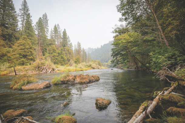
The Trinity Wild and Scenic River, located in northern California, features many BLM-managed campgrounds open to the public. Many BLM campgrounds feature basic amenities, like pit toilets. (Photo: Josh Jackson)
DOERING: Oh my gosh.
JACKSON: So it's this really crazy, like there's old growth redwood and douglas fir forest, it's a hot spot for biodiversity, the Northern Spotted Owl can be seen there, lots of wildlife, bears, mountain lions, mule deer, it's this really, really special area, but there's also a huge trail network for hikers. There's four BLM managed campgrounds, one of them's right on the coast, called the Mattole Beach Campground, right where the Mattole Estuary is. There's the Lost Coast Trail, which is this famous trail that runs 25 miles from the Mattole Beach Campground, which is in the northern part of the King Range, to another south. If you walk south, most people walk south, 25 miles right on the coast, and you're walking in some of the most pristine habitat you can imagine, for like elephant seals and black bears and mountain lions, and yeah, it's an incredible area. It's really hard to get to, but it is accessible, you know. If you have a car, all those campgrounds in there are first come, first serve, and there are some amenities. There's a little town called Shelter Cove. Yeah, it's a really, really special place. I wrote about it for a reason, you know. It's like not many people think of BLM lands on the ocean, but this is like one of those places. It's where my, we go up every year. It's my kind of my kids' second home, because we spend so much time up there. And I write about this in the book, but a story behind how the King Range was saved and preserved is one of the most remarkable stories in, like, American history.
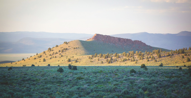
The Bodie Hills is another BLM spot that Jackson recommends for camping. They are located north of Mono Lake, and serve as a transition zone between the Sierra Nevada and the Great Basin. (Photo: Josh Jackson)
DOERING: That's right! So, yes, because this started with, was it a Democrat who proposed this? And then tell us the story of how this, this was a really bipartisan long-term effort to get this place protected.
JACKSON: Yes, so these were lands that were BLM managed lands, somehow the BLM, you know, we talked about these being the leftover lands. It's kind of shocking that these lands along the coast were actually under the jurisdiction of the BLM. So, the BLM was formed 1946, in 1960 there was a Democratic congressman named Clement Miller, who his district kind of ran up the coast there, and he gives this amazing hour, you can find this speech online, but he gave an hour long speech on the house floor about protecting this particular stretch of land called the King Range National Conservation Area. I mean, he's the first one ever to even consider that BLM land would be designated for conservation and recreation, at this point the BLM is only 14 years old, and they called it the Bureau of Livestock and Mining, because if you thought of BLM land, all you thought about was cows and mining. So this Clement Miller, and he was like the reason the Point Reyes National Seashore was designated, there's a picture of him standing behind JFK when that designation happened. So he proposes let's protect this King Range National Conservation Area. He actually says in his speech, I'm hoping for a Cinderella transformation at the BLM, like beautiful language, right? And at the time that would have been shocking, like, wait, we're gonna protect this for conservation and recreation, that makes no sense, but he pushed for it. His bill doesn't even make it out of committee. The next year he pushes for it again, doesn't even make it out of committee. And then a month before the 1962 election, he's flying in an airplane to a campaign event, and the airplane actually crashes; him, and the pilot and his son all die in this crash, and ironically one of the last places he would have seen from the airplane was as they were flying over the Lost Coast, the exact place that he wanted to protect. So, he dies a month before the election. His opponent, a Republican, Donald Clausen, ends up winning in January. So, he died so close to the election that they didn't even have an election for that seat, so Donald Clausen ends up winning the election early the next year. It assumes Clements Miller's seat, and then shockingly he takes over the mantle for trying to protect the King Range, so he pitches it over and over and over and over again, and on the 12th attempt, 10 years later, it finally passes, and like becomes the King Range National Conservation Area. So it was like this crazy bipartisan story. Donald Clausen had this thing hanging, he was a congressman, I think, for like 20, 25 years up into the early 80s in that district, and he has this kind of plaque hanging in the office where I'm paraphrasing here, but it essentially said something like, you can get a lot done where you don't care who gets the credit.
The Bodie Hills are also renowned for their vast expanses of sagebrush, which grows in silvery-green carpets across much of the desert West. (Photo: Josh Jackson)
DOERING: Oh, wow.
JACKSON: This like beautiful, kind of bipartisan, like working for the people, kind of quote. And he was known as that kind of guy, but he helped get Redwood National Park designated. He was the reason behind the King Range National Conservation Area, but yeah, the backstory there's like it's much longer and lots more details that I skipped over, but it's truly remarkable, this bipartisan remarkable story of protection for the land, and then you add in all the remoteness and like this, the biodiversity, and like it's just this really like. I think most people go there, and they think, why isn't this a national park? It's so beautiful, you know. But if it was a national park, it would be a lot more crowded.
DOERING: Exactly,
JACKSON: There'd be like a lot more infrastructure that would, it would take away from how special it is there.
DOERING: Yeah, and very bipartisan work.
JACKSON: Yep.
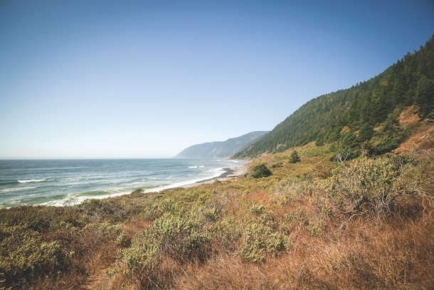
Though many may not think of BLM public lands being coastal, the King Range National Conservation area in northern California includes amazing access to the coastline near 4000 foot mountains. (Photo: Josh Jackson)
DOERING: Yeah so, of course I mean there was a long time of intense extraction, theft of these lands from Native Americans, realizing that you know maybe we should be protecting some of these places as wilderness, as places “untrammeled by man,” right, which is a complicated phrase, and more recently we have been collectively realizing the importance of the longstanding relationship of Native Americans with the land. There's a Land Back movement we've reported on, including in California. So, how do you think about holding this complicated past and present all in one as you visit these public lands, you know, the theft from Native Americans, acknowledging the dark history of colonialism and genocide, as well as enjoying these lands for what they are now?
JACKSON: It's a great question. Yeah, to my Indigenous friends, like these lands were never forgotten, right? They're not forgotten lands, they weren't leftover lands to them, these were their homelands, these were places that they lived and worked on the land for thousands of years, right. And so there's a great book called Tending the Wild, where M. Kat Anderson writes that they knit themselves to nature, and I think that's such a beautiful phrase of the way that Indigenous people can have this deep, deep reciprocal relationship with the land, where the land's giving to them, they're giving back, and so we have so much to learn, right? And I think acknowledging that awful history is the first step. The second step, and something I carried with me, and still carry with me to all the places that I visit, is trying to understand and learn the history of these people, because they're not gone, they are still here. My Indigenous friends are still living on these lands, and they might not be their land, but they are our shared lands. One of the things that's really so interesting about the BLM is because it's so like some of these new national monuments, for example, are so new and so recently designated, we actually have co-management plans now, which is kind of unheard of, like if you think of the National Park Service or US Fish and Wildlife or US Forest Service. The BLM has this really special relationship in different parts of the West with tribes where they co-manage the land together or co-steward the land together, so you have like a whole place, like I write about a place up in Berryessa National Monument, which is in Northern California, that was expanded under Biden Moloch Loyok, which in Patwin means Condor Ridge, I think it's like around 16 to 20,000 acres of land that was added to that national monument, and the Patwin tribes actually manage that land alongside the BLM, so it's not just land back, because that is happening too, but you have like tribal co-management happening with the BLM. So who knows these landscapes better than tribes, right? I mean, it's like in deep in their bones, and so that's another cool thing that we're, we're doing as we move into the future is these tribal co-managements, which is having a big net positive on the landscape.
This photo was taken at the Berryessa Snow Mountain National Monument, an area of public land in northern California co-managed by the Bureau of Land Management and two local Indigenous tribes; the Yocha Dehe Wintun Nation and the Kletsel Dehe Wintun Nation. (Photo: Josh Jackson)
DOERING: Josh Jackson is the founder of Forgotten Lands Project and the author of The Enduring Wild: A Journey Into California's Public Lands. Thank you so much, Josh. This has been a real pleasure.
JACKSON: Thanks so much for having me.
Related links:
- Purchase The Enduring Wild: A Journey Into California’s Public Lands and support Living on Earth and independent booksellers
- Visit the Bureau of Land Management Website and learn more about camping and recreational opportunities
- Josh Jackson is the founder of the Forgotten Land Project, which is committed to sharing the story and wonder of public lands
DOERING: And Steve, you might recall that a few years ago we reported on co-management and land back for the Yurok tribe in northern California.
CURWOOD: That’s right, it was a historic land transfer as I recall.
DOERING: It was, 125 acres in 2024, and then in 2025 there was a much bigger transfer of 47,000 acres to the Yurok tribe. One key goal is handing back stewardship of the salmon runs that are vital to Yurok culture. And as it turns out, we have a Living on Earth Book Club event coming up that’s all about that relationship between the Yurok people and the salmon.
CURWOOD: Yes, this is for the book The Water Remembers. July 14th, right?
DOERING: That’s right, July 14th at 8 pm Eastern on Zoom, and it’s free of course!
We’ll talk with Amy Bowers Cordalis about The Water Remembers: My Indigenous Family’s Fight to Save A River and a Way of Life. Register to join us July 14th, 8 pm Eastern at loe.org/events! That’s loe.org/events.
[MUSIC: High Desert Pulse]
CURWOOD: Coming up after the break, The remarkable yet unplanned regrowth of American forests in the Northeast. Keep listening to Living on Earth!
ANNOUNCER: Support for Living on Earth comes from the estate of Rosamund Stone Zander - celebrated painter, environmentalist, and author of The Art of Possibility – who inspired others to see the profound interconnectedness of all living things, and to act with courage and creativity on behalf of our planet. Support also comes from Sailors for the Sea and Oceana. Helping boaters race clean, sail green and protect the seas they love. More information at sailorsforthesea.org.
[CUTAWAY MUSIC: High Desert Pulse]
The Spectacular Regrowth of New England Forests
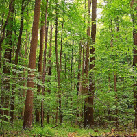
This second-growth forest in New Jersey was once a plot of farmland; it has since become a mature deciduous forest. (Photo: Nicholas A. Tonelli, Wikimedia Commons, CC BY 2.0)
DOERING: It’s Living on Earth, I’m Jenni Doering
CURWOOD: And I’m Steve Curwood.
When we take a look at the history of the United States, after the European colonists landed, some of the most dramatic changes they made were to the landscape, and especially our forests. Clearcutting ran rampant, but now, on the 250th birthday of the United States, much of our forests have recovered, particularly in the Northeast.
DOERING: Since they function as carbon sinks, maintaining our forests is a key tool we have for mitigating the effects of climate change. During negotiations for the Kyoto Protocol, the United States even tried to argue that our forests should be taken into account as an offset for our historic carbon emissions.
CURWOOD: Joining us now is Bill Moomaw, Tufts Emeritus Professor and a Distinguished Visiting Scientist at the Woodwell Climate Research Center. He was a lead author of several Intergovernmental Panel on Climate Change reports, and the organization shared the Nobel Peace Prize in 2007 along with US Vice President Al Gore. Bill has spent decades studying how the process of rebuilding American forests could shape the country’s climate future, but I started off asking him to look back in history to when the United States was just getting started.
MOOMAW: Well, it's remarkable. John Winthrop is quoted as after arriving on the Mayflower: "We have been sent to a wilderness filled with savages and wild beasts." Clearly, they weren't impressed with the massive forest they saw or the people who were here, and this notion that the forests were in the way of making the new world not look like England. And to make it look like England, they had to have agriculture, they had to clear forests for their villages, come cities, and it didn't stop there. The value of the tall white pines in the primary forest that were here were so magnificent that the sovereign in England required that they all be saved for Her Majesty's ships in order to have the tallest masts, taller than the Spaniards, for example, and it was just seen as a resource and a barrier, and therefore it had to be removed. And that's the New England part and the Virginia part, which were the first areas settled.
CURWOOD: So we're talking about King Pines, huh?
MOOMAW: King Pines, absolutely.
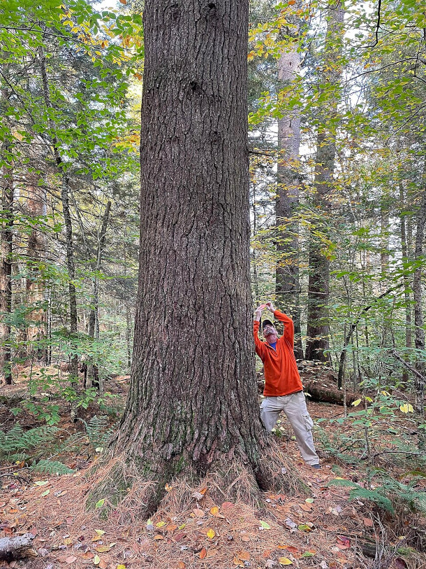
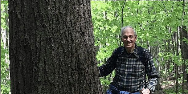
A large white pine towers above an observer in William Cullen Bryant Homestead, located in Cummington, MA. (Photo: Marty Aligata, Wikimedia Commons, CC BY-SA 4.0)
CURWOOD: So, how much of the forest was lost in the Northeast once the Europeans came?
MOOMAW: Well, it took a little while, but by 1850 New England was probably 80% deforested, and in some places 90% and 100% I mean, it was just absolutely decimated. And it wasn't until after 1900 when Gifford Pinchot returned from Europe, learning how the Europeans had managed their forest in order to be a resource for hundreds if not thousands of years, that we changed our practices from just wanton destruction. I mean, we were cutting down whole hemlock forests in the Northeast, in New England, just to get the bark, to get the tannin to tan leather, and the rest was just dumped and then burned, so these raging fires in New Hampshire, and so forth, as they were just burning the wood that they had cut down.
CURWOOD: So, actually, what was needed to happen to have the forest come back in the Northeast? We'll talk about the rest of the country in a moment, but what kind of recovery did we see for the forest in the northeast?
MOOMAW: Well, it's a remarkable story, but what happened was — just to give you an example — Massachusetts, which is the, I think, the third most densely populated state in the United States, is 60% forested today. Now, it was probably 90% plus forested when the Europeans arrived, but it went through a period in which 80 to 90% of the forest was removed, and that was exacerbated between 1850 and 1900 by the railroads. The railroads had to be fueled, they were fueled by burning wood to make steam. The railroad tracks had to have ties, trees were cut down to make ties for railroads, so what we extol is this great industrialization that carried in America in the last half of the 19th century was a disaster for the forests. But around 1850, the Ohio territories were opening up, and so New England farmers who had been cutting down forests and then plowing the rocks discovered all you had to do in Ohio was cut down the forest, and there were no rocks. And so they abandoned their farmland, and the regrowth of forest in the northeast US, particularly New England, is the greatest forest recovery in the history of the world, and it all happened because of what I call benign neglect. It was not a plan, it was just abandonment of agricultural lands that receded spontaneously for the most part. Now, in other parts of the country, forests that were cut were then turned into giant tree plantations of single species. Same is happening in the southeast, actually, didn't happen so much in the northeast. So we didn't really plant our way back into forests, we planted our way back into tree farms, because if you're a forester and you have a piece of land you wanted to improve it, meaning to replace the trees you'd cut down with the trees you wanted to cut the next time, so the species were changed to accommodate that. And so we didn't get our natural forest back in some parts of the country, but in New England we pretty much did. It's remarkable what has happened in the last hundred years.
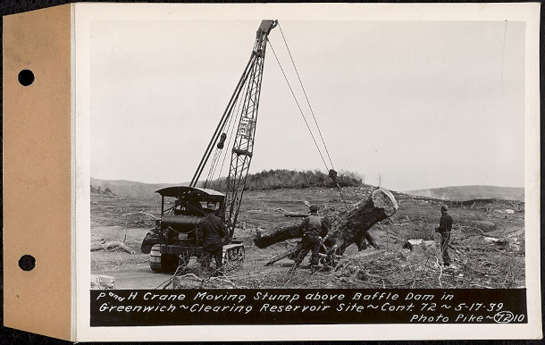
A crane moves a tree trunk in 1939 to clear a site for the new Quabbin Reservoir in Massachusetts. (Photo: Metropolitan District Water Supply Commission, Wikimedia Commons, public domain)
CURWOOD: So, here are the 250th anniversary of the United States, and it begins in the east and northeast. We start by cutting down all the trees, essentially we can celebrate that they're mostly back. Huh?
MOOMAW: Well, we can. I think it is worth celebrating too. I mean, the battle's not over, in the sense that you know most states have a department of natural resources, which means that a forest is considered a resource. A resource is something to be exploited for economic reasons. And then there's been this huge battle going back to the late 19th century that somehow some people thought, well, we should save some of our forests. So John Muir is the most famous person who was advocating that, and so while Gifford Pinchot was saying we needed to use it as a resource and use it wisely, Muir is saying it was somehow sacred and should be protected, and that's been the debate. And there's now a third view, which is forests and other ecosystems are essential components of the earth's operating system. This is why we're talking about them, for climate, for example, and in that role we can't have a planet that has the climate that made our whole civilization possible if we don't have forests and oceans and other ecosystems that are functional.
CURWOOD: Bill, we've talked a lot about the forests of the Northeast. Tell me a little bit about the other forests throughout the United States. What should we be celebrating about those at the 250th?
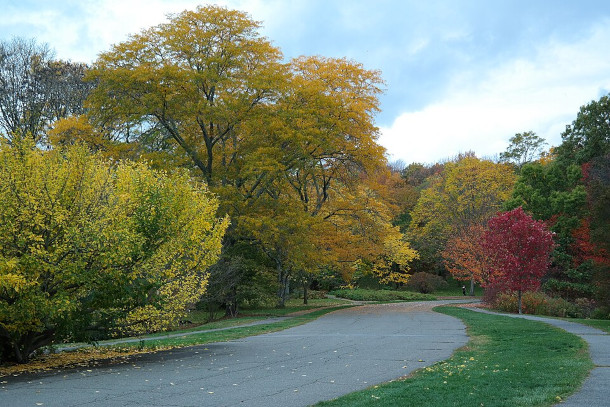
The Arnold Arboretum in Massachusetts is a large, designed landscape within Boston’s city limits. But Bill Moomaw says much of New England’s forests were recovered not through purposeful design, but rather through “benign neglect”. (Photo: TanRo, Wikimedia Commons, CC BY-SA 4.0)
MOOMAW: Well in the upper Midwest, those were all devastated in the last half of the 19th century. Again, I said mostly for the railroads, and those forests have begun to come back, just as ours have, in a more deliberate way. The Pacific Northwest and California, I mean, you think about the redwoods and the giant sequoias and everything. There's some extraordinary photographs of lumbermen vying with each other to cut down the biggest redwood, to cut down the biggest sequoia, and it was all done by hand, of course. And this was a great feat, and was seen as such. It got to the point that we had removed 90% of the coastal redwoods. These trees that are 2000 years old, they were all cut down and used for everything from toothpicks to clothespins to whatever. So those forests, of course, are now protected. You may recall that when Ronald Reagan was president, he opposed creating a redwoods national park, because, as he said, when you've seen one redwood, you've seen them all. That was kind of the attitude that a lot of people had. But now we have some of our greatest national parks in the west, and they're protecting some areas, but they're relatively small areas compared to the total forests. And what we're discovering is that the forests that have been left are doing the really heavy lifting, the ones that have been allowed to keep growing, which is what I call proforestation, that is letting the forest continue to grow, to accumulate carbon and to develop its full biodiverse potential, is another way of managing forests rather than cutting them down and then letting them grow back and then cutting them down again.
CURWOOD: So, Bill, I understand you collaborated with folks to write a major paper on proforestation. What was that paper, and what did it say, in sum?
MOOMAW: Well, actually, it's the paper that invented the term, because there was no word for it. Forestation means to grow a forest, deforestation means to take it down, reforestation means to replant it, afforestation means to plant trees somewhere, and there was no term for permitting forests to continue growing to achieve their potential for carbon accumulation and biodiversity. And we carefully phrased it that way, "achieve its potential," because different forests are in different locations with different soils and different climates, and so on, and so we wanted to make it general enough, but get the concept across.
CURWOOD: Bill, you worked a lot with the Intergovernmental Panel on Climate Change. What did you folks have to say there about trees?
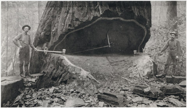
Two Union Lumber Co. employees fell a redwood in Fort Bragg, California. This photo, from an unknown year in the 20th century, is a reproduction from the original negatives in the Georgia-Pacific Corporation Archives. (Photo: Georgia-Pacific Corporation Archives, Wikimedia Commons, public domain)
MOOMAW: Well, actually, when I was working on it, it was mostly about the technologies, and just beginning to recognize that, amazing fact, the increase in carbon dioxide every year in the atmosphere is less than half of what we put in. And it took a long time to figure out why that was happening, and where that carbon dioxide was going, and it turns out, of course, it's going into forests and other plants on land, primarily forests and in the oceans, but it took a long time to find out just exactly where that was going and how it was getting there. And more recent reports, they're now making statements that I couldn't have imagined being made during the era when I was working on it. Here's just one: "Safeguarding biodiversity and ecosystems is fundamental to climate resilient development." That's a pretty strong statement for a bunch of engineers and climate modelers, and so forth. "Maintaining the resilience of biodiversity and ecosystem services at a global scale depends on effective and equitable conservation of approximately 30 to 50% of Earth's land, fresh water, and ocean areas, including currently near natural ecosystems." And that statement is made with high confidence. Now it's interesting, because E.O. Wilson, his last great work was Earth needs half, so it's interesting that the climate scientists are coming up with similar sorts of things, and then I was very pleased to see this one, because it referred to our paper on proforestation. It said "Protection of existing natural forest ecosystems is the highest priority for reducing greenhouse gas emissions, and restoration may not always be practical." And then it cites our paper on proforestation, and a number of studies have concluded that globally, forests could store twice their current carbon stocks, and some of that's done regionally, and some of it's done globally, and it all comes out about that number.
Tufts University Emeritus Professor William Moomaw is a Distinguished Visiting Scientist at Woodwell Climate Research Center. He has been a contributing author to several Intergovernmental Panel on Climate Change reports, the group that shared the Nobel Peace Prize in 2007, with Vice President Al Gore. (Photo: Courtesy of Bill Moomaw)
CURWOOD: So, Professor Moomaw, looking ahead for another 250 years here in America, how do you think our forest management will change? How should it change?
MOOMAW: Well, I think it needs to change in a way that protects a large enough percentage that it will be able to maintain both the global climate and our regional weather conditions. So, for example, the Northeast temperature rise with global warming is significantly less than the global warming is doing because we are so heavily forested. And those forests are both providing shade, but they're also, in order to grow, they have to draw water up into their trunks, and the water contains minerals and nutrients they need, and then they evaporate the water from the leaves, and as the water evaporates from the leaves, it cools the surrounding area, and so Boston, for example, is probably three or four degrees cooler than it has any right to be, because of global warming. In other words, the global warming would make it that much warmer, but our forests are cooling it by that amount, so it has a huge benefit from that point of view. And that has economic consequences, by the way. A few years back, when Worcester, Massachusetts had to cut, I think, was 30,000 trees that were infected the following summer, the air conditioning electricity use went up dramatically, and we can't all stay inside. People building houses can't be air conditioned while they're building houses, they have to work outdoors. Farmers have to work outdoors. So I think it's just really important that we have a climate that is suitable for all of us.
CURWOOD: Bill Moomaw is a Distinguished Visiting Scientist at the Woodwell Climate Research Center. Thanks so much for taking the time with us today, Bill.
MOOMAW: Thank you very much for having me. I really appreciate the opportunity.
[MUSIC: Moss and Fern]
Tongass National Forest is the largest national forest in the United States. At nearly 17 million acres, it is larger than several U.S. states. (Photo: Mark Brennan, Wikimedia Commons, CC BY-SA 2.0)
CURWOOD: By the way, though the Tongass National Forest in Southeast Alaska has less than ten percent of our national forest acreage, the Woodwell Climate Research Center says its peat-rich soils and dense old growth trees sequester fully 40 percent of the carbon in our national forest system. The Tongass, with many 200-foot-tall evergreens more than ten feet in diameter, and with some cedars as much as 4 thousand years old is also the largest remaining temperate rainforest on Earth. Its preservation is a prime example of the pro-forestry espoused by Professor Moomaw. It takes no new technology to stop cutting down trees to fight climate change, just action on the awareness of their value. And that is why the Tongass National Forest is often called America’s climate sanctuary.
[MUSIC: Moss and Fern]
Related links:
- Conservation Science and Practice | Protect Large Trees for Climate Mitigation, Biodiversity, and Forest Resilience
- MDPI |Creating Strategic Reserves to Protect Forest Carbon and Reduce Biodiversity Losses in the United States by Law, Moomaw,Hudiberg,Schlesinger,Sterman and Woodwell
- The Bulletin | “Does Wood Bioenergy Help or Harm the Climate?”
- Watch a recent presentation from Bill Moomaw on the history of forests in Concord, Massachusetts
CURWOOD: Living on Earth is produced by the World Media Foundation. Our crew includes Naomi Arenberg, Paloma Beltran, Mia DiLorenzo, Abby Edgecumbe, Swayam Gagneja, Mark Kausch, Mark Seth Lender, Don Lyman, Ashanti Mclean, Nhung Nguyen, Aynsley O’Neill, Sophia Pandelidis, Jake Rego, Andrew Skerritt, Bella Smith, and El Wilson.
DOERING: Tom Tiger engineered our show. Allison Lirish Dean composed our themes.
You can hear us anytime at L-O-E dot org, Apple Podcasts and YouTube Music, and like us please, on our Facebook page, Living on Earth. Find us on Instagram, Threads and BlueSky @livingonearthradio. And we always welcome your feedback at comments at loe.org. I’m Jenni Doering
CURWOOD: And I’m Steve Curwood. Happy Birthday America!
ANNOUNCER: Funding for Living on Earth comes from you, our listeners, and from the University of Massachusetts, Boston, in association with its School for the Environment, developing the next generation of environmental leaders. And from the Grantham Foundation for the protection of the environment, supporting strategic communications and collaboration in solving the world’s most pressing environmental problems.
ANNOUNCER 2: PRX.
Living on Earth wants to hear from you!
Living on Earth
62 Calef Highway, Suite 212
Lee, NH 03861
Telephone: 617-287-4121
E-mail: comments@loe.org
Newsletter [Click here]
Donate to Living on Earth!
Living on Earth is an independent media program and relies entirely on contributions from listeners and institutions supporting public service. Please donate now to preserve an independent environmental voice.
NewsletterLiving on Earth offers a weekly delivery of the show's rundown to your mailbox. Sign up for our newsletter today!
![]() Sailors For The Sea: Be the change you want to sea.
Sailors For The Sea: Be the change you want to sea.
 The Grantham Foundation for the Protection of the Environment: Committed to protecting and improving the health of the global environment.
 Contribute to Living on Earth and receive, as our gift to you, an archival print of one of Mark Seth Lender's extraordinary wildlife photographs. Follow the link to see Mark's current collection of photographs.
 Buy a signed copy of Mark Seth Lender's book Smeagull the Seagull & support Living on Earth
© Copyright World Media Foundation. All Rights Reserved
Home | Contact | RSS | Donate | Newsletter