Google Street View for the Amazon
Air Date: Week of April 6, 2012
 |
A team from Google recently went to the Amazon to make a "street view" of the forest and river for Google Maps. Karin Tuxen-Bettman is a geo data strategist at Google. She talks with host Bruce Gellerman about taking street view photos in a place with no streets.
Transcript
[SOUNDS OF BOAT AND WATER AND BIRDS]
GELLERMAN: A few years back I traveled through the Amazon, trekking through the forest and traveling by boat along muddy tributaries. It was amazing.And while I didn’t encounter bloodthirsty ants, deadly snakes, or poisonous arrows - I did nearly get eaten alive by some unseen insects.
But for those you who want to experience the vast Amazon rainforest but prefer your adventures from an armchair perspective - pull up a seat, relax, and click on the latest offering from Google Maps. Karin Tuxen-Bettman is a GeoData Strategist at the internet search company and Project Lead for Google Street View in the Amazon. Karin - welcome to Living on Earth.
TUXEN-BETTMAN: Thanks for having me, Bruce.
GELLERMAN: So, how does this work?
TUXEN-BETTMAN: Well, if you go to Google Maps at maps.google.com, and you scroll to the Amazon basin, zoom in to the state of Amazonas, and you can drag the little Street View peg man onto the map - onto the Rio Negro or onto one of the small communities where we collected street view data or one of the forest trails and once you’re there, you can click forward in the panorama, you can click backwards, you can click up, click down, and move all around and explore the forest, explore the river and walk around the five communities that we collected data from.
GELLERMAN: Well, I’m on the site and I’m clicking and I…oh, that cool! I’m at the trail entrance to Amazon Rainforest… whoa, look at that, you can kind of just feel like you’re walking through the rainforest!
TUXEN-BETTMAN: That’s right - you can just click forward, you can double click to move forward in space and to zoom in on a specific tree. You can look up - in one area you can look up and see a swarm of dragonflies flying overhead. And then you can drag the peg man to a completely different area, maybe along the river, and you can float down the river and you can see submerged trees and flooded forests and even one area you can see a little tree frog climbing onto the camera, so there’s quite a lot to see and it’s just stunning imagery, and it really is just like you’re there.
GELLERMAN: So, I feel like I’m walking through the forest - if I click, it feels like I’m walking on the trail - how did you make this photo?
TUXEN-BETTMAN: Well, when we went down to the Amazon in August, we took two different pieces of equipment. The first one was a street view trike - and we mounted the trike on a boat and we floated around and collected imagery with the street view trike mounted on the roof of the boat. And then we also had a Street View trike that we peddled around the communities.
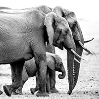
Trail entrance to the Amazon rainforest. (Google)
GELLERMAN: When you say trike, you mean a tricycle!
TUXEN-BETTMAN: That’s right. The Street View trike was created to go places with no roads. But the forest trail we actually used a different equipment - we used a camera on a tripod and the camera had a fisheye lens. And we took photographs in four different directions, and we then stitched those photographs together into a 360 degree panorama.
GELLERMAN: Why did you go in August?
TUXEN-BETTMAN: Why did we go in August - that’s a good question. This entire project was envisioned by our non-profit partner: Amazonas Sustainable Foundation. So they wanted to capture August, which was at kind of a good balance between the wet and dry seasons, and they wanted to be able to go up into the tributaries - the Rio Negro tributaries, so that people could see the flooded forests for themselves.
GELLERMAN: So how could this possibly help the environment and the people in the Amazon?
TUXEN-BETTMAN: The Amazonas Sustainable Foundation sees this project as applying technology to forest conservation and allowing people to see the imagery on Google Maps and Google Earth for themselves so that they can get to know the forest a little bit and understand what they might want to work at conserving.
GELLERMAN: Where does the technology go? How much more can you do?
TUXEN-BETTMAN: Google’s primary goal with Street View is to create a digital mirror of the entire world. And we want to make it so that armchair environmentalists can actually visit these places before and after, and with a mobile phone, possibly during their travels and make getting around easier. Also, understanding different places and the culture and the environment that exists there. And so I think where this technology goes is just further - more places that have invited us to come or more places that might invite us in the future.
GELLERMAN: Well, Karin, thanks so very much.
TUXEN-BETTMAN: Oh, you're so very welcome.
GELLERMAN: Karin Tuxen-Bettman is a Geo Data Strategist at Google. To take their virtual voyage through the Amazon…click on our website L-O-E dot O-R-G.
Links
Living on Earth wants to hear from you!
Living on Earth
62 Calef Highway, Suite 212
Lee, NH 03861
Telephone: 617-287-4121
E-mail: comments@loe.org
Newsletter [Click here]
Donate to Living on Earth!
Living on Earth is an independent media program and relies entirely on contributions from listeners and institutions supporting public service. Please donate now to preserve an independent environmental voice.
NewsletterLiving on Earth offers a weekly delivery of the show's rundown to your mailbox. Sign up for our newsletter today!
![]() Sailors For The Sea: Be the change you want to sea.
Sailors For The Sea: Be the change you want to sea.
 The Grantham Foundation for the Protection of the Environment: Committed to protecting and improving the health of the global environment.
 Contribute to Living on Earth and receive, as our gift to you, an archival print of one of Mark Seth Lender's extraordinary wildlife photographs. Follow the link to see Mark's current collection of photographs.
 Buy a signed copy of Mark Seth Lender's book Smeagull the Seagull & support Living on Earth
© Copyright World Media Foundation. All Rights Reserved
Home | Contact | RSS | Donate | Newsletter